Takeoff for underground utilities & erosion control

The takeoff draws itself.
You check the work.

Upload the plan set. Pipe runs, structures and erosion control come back found, classified and measured — in real feet, with the evidence for every line — before an estimator picks up a tool.

Start free See it work No card. Your first plan set in minutes.
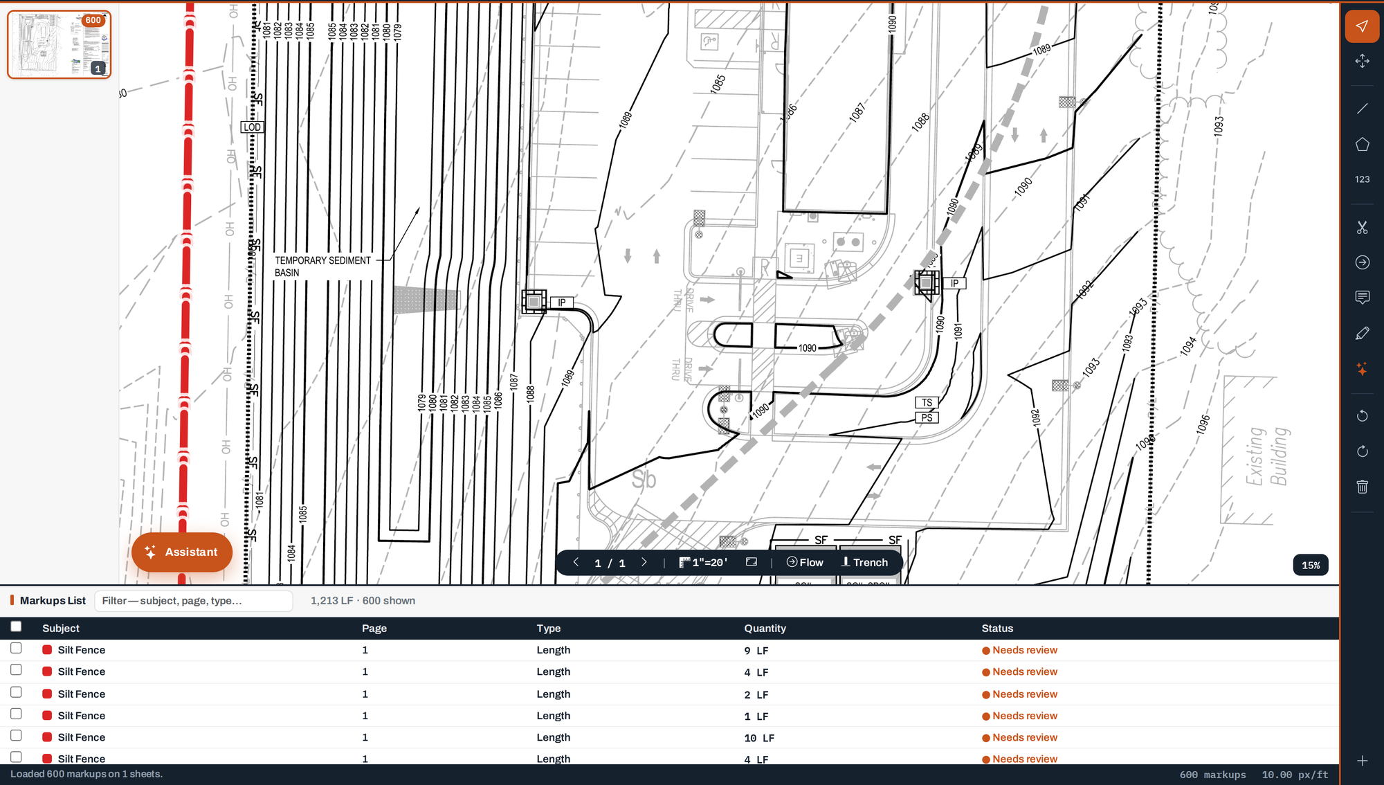
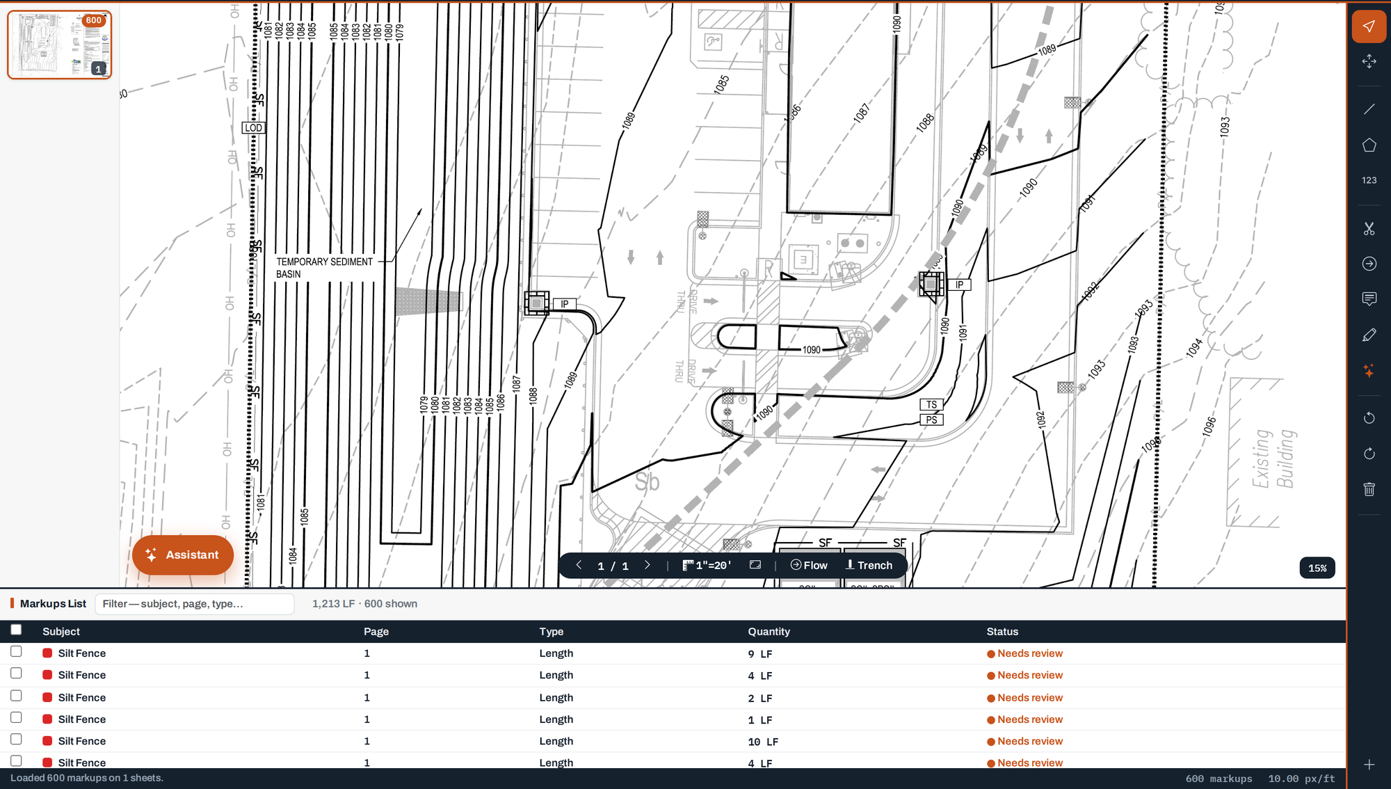
erosion control plan  ·  1"=20'
The erosion control sheet as it arrives, unmarked The same sheet after the platform traced and measured the silt fence
plan as receivedtakeoff, measured
1,213 LF silt fence  ·  600 markups  ·  10.00 px/ft
~90 minof review turns a fresh plan set into a finished takeoff
8 / 8sheets scaled automatically on a typical set — no scale bar to pick
0quantities printed without a verified scale. Blank beats wrong
.dwgupload the CAD drawing itself and the layers come through exact
01

Upload. Review. Bid.

No new discipline to learn. The platform does the tracing an estimator would have done by hand, then asks you to confirm it — item by item, at keyboard speed.

STEP 01

Drop the plan set in

A PDF, a whole ZIP of them, or the CAD drawing itself. Tag which sheet is which — or let it work that out — and walk away. The bell rings when the markup is ready.

STEP 02

It reads the sheet

The printed scale bar is measured, the CAD layers are read, pipe runs and erosion items are traced from the engineer's own linework and labels, and every find is checked before it reaches you.

STEP 03

You confirm, it totals

Work the review queue with Y and N. Quantities roll up live into the workbook your estimators already use — and into a client-ready PDF when you need one.

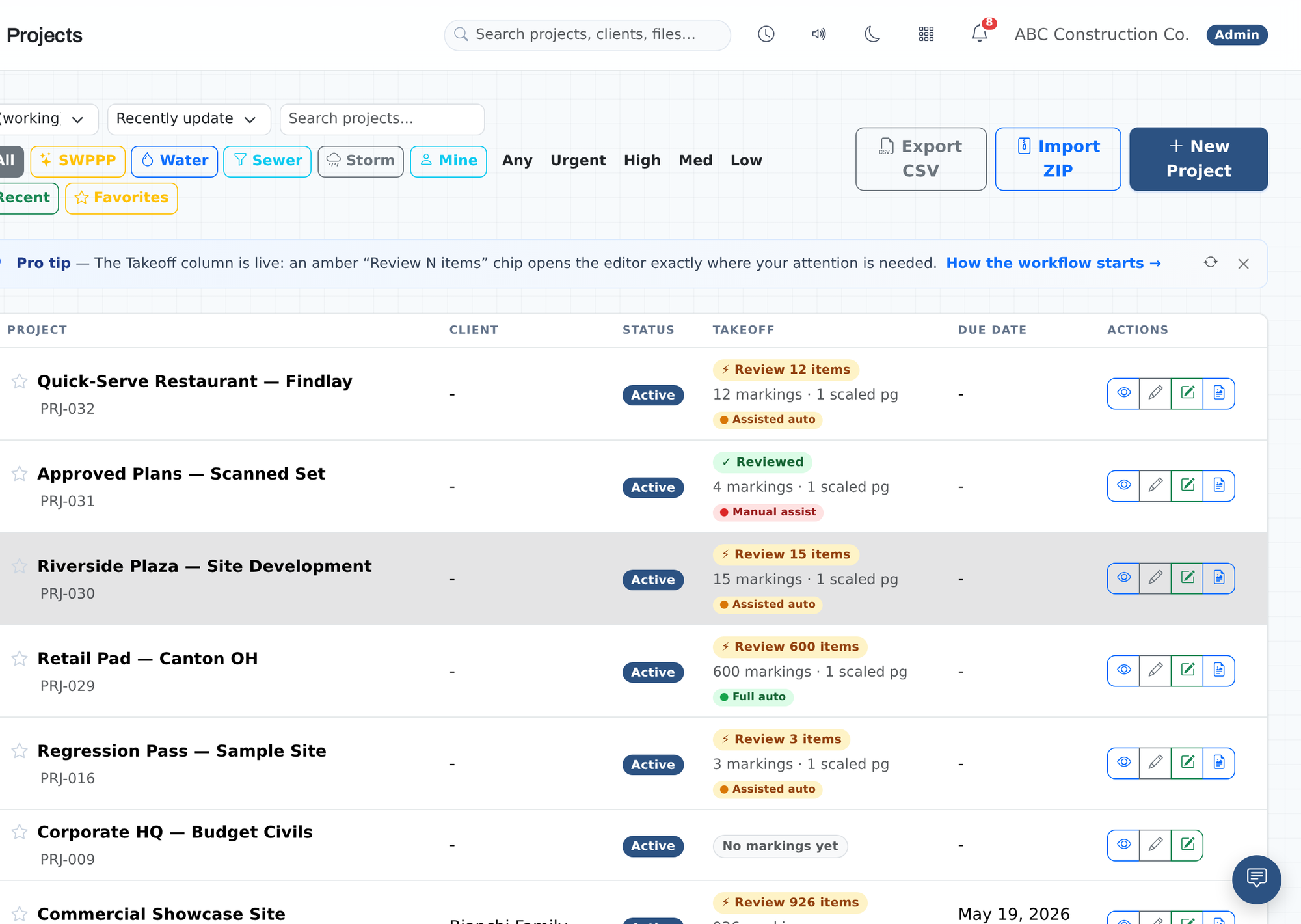
Every job's state, at a glance

The list tells you what the platform did and what it wants from you: how many items are waiting, how many sheets are scaled, and how much of the work was automatic.

  • Full auto — layered CAD plan, read directly from the engineer's layers
  • Assisted auto — a flattened print; found by image, flagged for your eyes
  • Reviewed — a human signed it off and it is ready to price
Projects
Project list showing live takeoff state per job

It measures in feet, or it says nothing

A takeoff is only worth the scale behind it. The platform measures the printed scale bar itself, and where it cannot verify one it leaves the cell blank and says scale required — rather than printing a number you might bid.

Storm Sanitary Water Erosion control
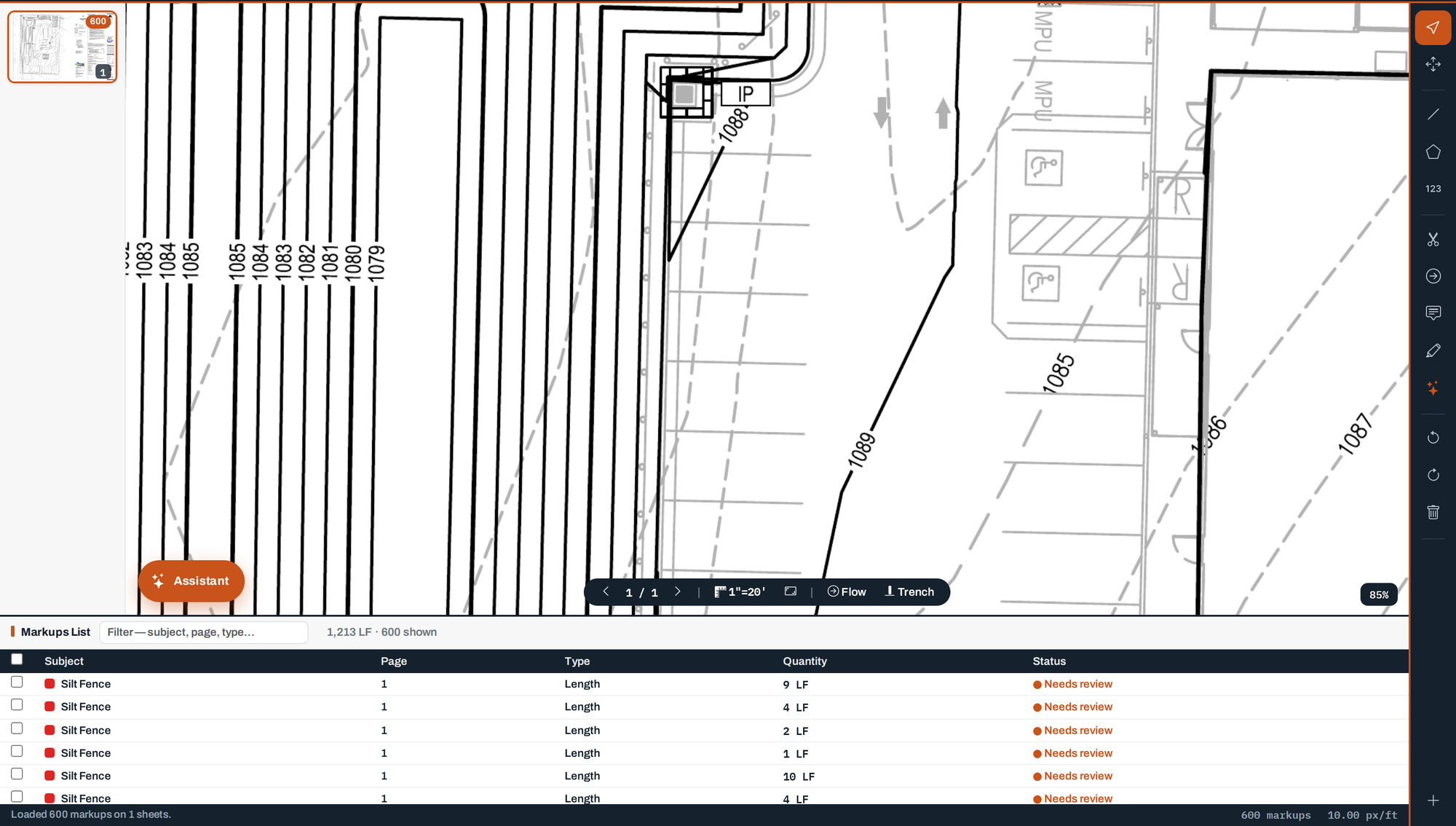
traced run  ·  detail
Zoomed detail of a traced silt fence run on the plan
02

Built by people who have read a plan set

Not a generic document tool pointed at drawings. Every behaviour below exists because an estimator hit the problem on a real bid.

CAD

Upload the drawing

A .dwg or .dxf is plotted for you at a proper engineering scale with every layer intact — exact layers, exact scale, nothing to calibrate.

TRACE

One click, whole run

Click any line and the run traces itself — through label gaps, printed dashes and crossings. Then it offers every other line drawn the same way as one batch.

EVIDENCE

Why it thinks so

Each marking shows its source: the CAD layer it came from, the plan label it was traced from, the schedule row that set its size. You review facts, not guesses.

SPEC

Size and material

Utility sheets print a pipe schedule. It is read and attached, so rows arrive as 18" RCP storm and 8" PVC sanitary — not as anonymous lengths.

BLUEBEAM

Fits your toolbox

Import your Revu tool chest one-to-one, and export the plan with every item as a real, editable markup you can open in Bluebeam.

SECOND LOOK

Ask for another opinion

When a pass does not look right, one click re-examines the mapped sheets against the plan — callouts, linework and schedules — and reports what it changed and why.

The numbers land where you bid

Quantities roll into the three-sheet estimator workbook — earthwork, erosion control, utility — with size, material and length on every row. Plus a branded takeoff report when the number has to leave the building.

  • Excel & CSV — straight into your pricing sheet
  • Annotated PDF — the plan with every accepted marking on it
  • Editable markups — live measurements in Bluebeam Revu
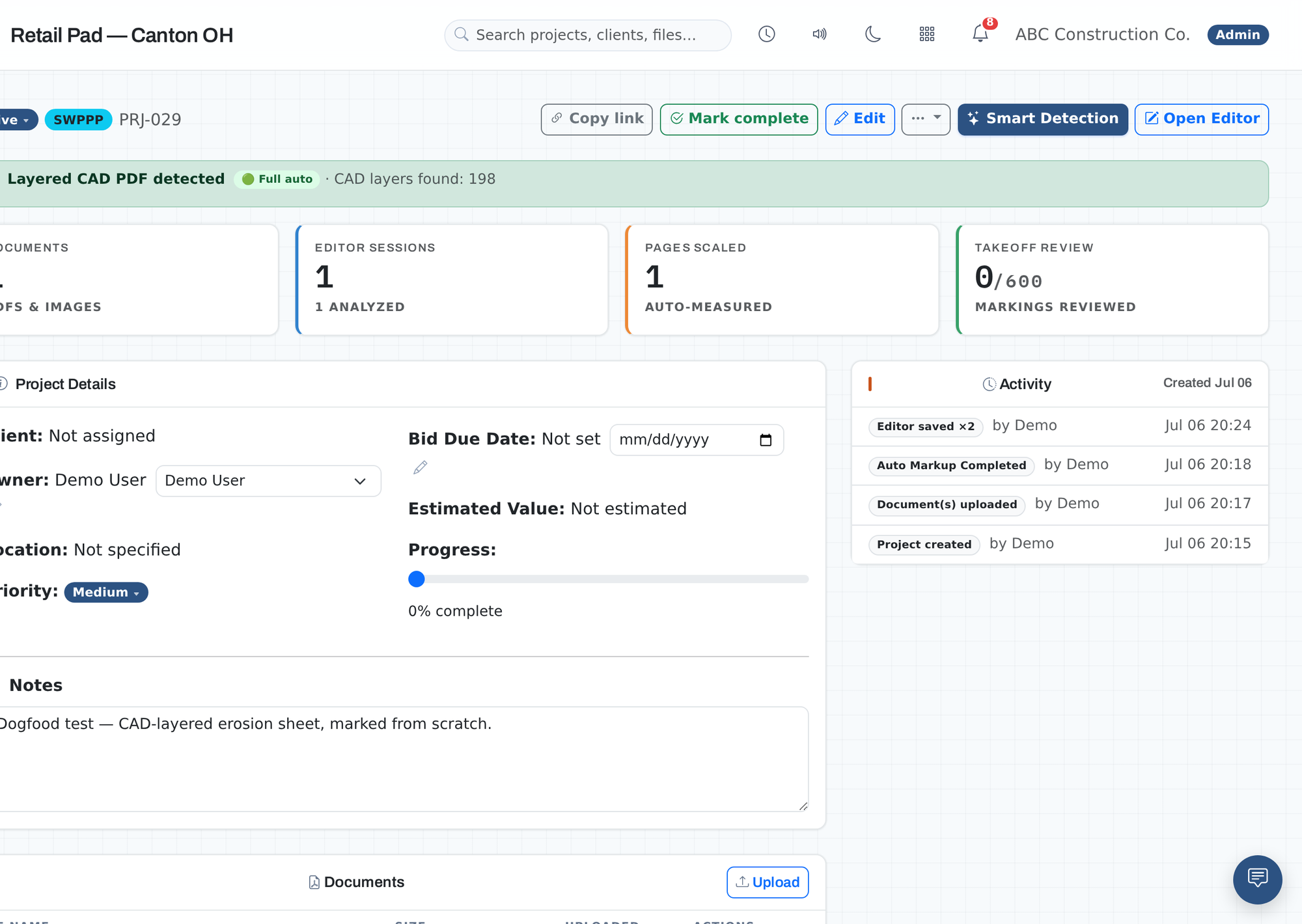
Project — takeoff summary
Project page with the detected takeoff summary
03

Priced per office, not per sheet

Every plan includes the full takeoff engine. What changes is how much work you put through it.

Starter

$49/month
  • Active projects 10
  • Plan storage 5GB
  • Automatic takeoffs 50/mo
  • Estimators Unlimited
Start free
Most chosen

Professional

$149/month
  • Active projects 50
  • Plan storage 25GB
  • Automatic takeoffs 250/mo
  • Estimators Unlimited
Start free

Enterprise

$299/month
  • Active projects 200
  • Plan storage 100GB
  • Automatic takeoffs 1000/mo
  • Estimators Unlimited
Start free

Erosion control, earthwork, demolition and fence are separate modules — switch on what you bid.

04

The questions estimators actually ask

How long does a plan set actually take?

About an hour and a half of review on a typical set — the platform does the tracing and the counting first, and what you spend your time on is confirming it. A small sheet is minutes. You are not learning a new way to work; you are checking work that is already done.

What if the PDF is a flattened print?

It still works, just differently. A layered CAD PDF is read directly from the engineer's layers — the most complete result. A flattened or scanned sheet falls back to image detection: items are suggested and flagged for your eyes rather than presented as fact. The platform tells you which kind you uploaded, and why it matters.

How do I know a number is right?

Every marking carries its evidence, and nothing is counted until a person confirms it. Where the scale cannot be verified, the length stays blank and says so — the one thing a takeoff must never do is print a confident wrong number.

We have the CAD file. Can we use it?

Yes — upload the .dwg or .dxf itself. It gets plotted at a standard engineering scale with every layer preserved, which is the most accurate input the platform accepts: the layers are exact rather than recovered from a print, and so is the scale.

Can two of us work on the same job?

Yes. You see who else is on the plan and which sheet they are on, their markings appear as they make them, and saves merge item by item — so nobody's work is overwritten by someone else's autosave.

Where does our plan data live?

In your own workspace, separated from every other company at every page and every API call. Larger teams can have the platform served from their own web address and certificate.
Start with the plan set on your desk right now

Put one bid through it and compare.

That is the only test that settles it. Upload a set you have already taken off by hand, and see what comes back.

Start free